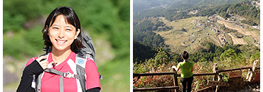
Mountain Writer, Ms. Chiho Kobayashi's Itinerary on the Kumano Kodo Iseji Route
Explore the nature and mountains of the Iseji Route through the eyes of Ms. Chiho Kobayashi. She will share the history and culture she has learned through communicating with the locals, visiting places of ancient worship and the pilgrimage route registered as a UNESCO World Heritage. She will also show you some local delicious foods.
Check out her exciting travel blog to experience the Iseji Route!
- to Day 1 Ise Jingu Naiku - Geku – Tamaru Distance of approximately
- to Day 2 Tamaru - Taki-cho Distance of approximately
- to Day 3 Misedani - Odai-cho (Skipped walking due to a typhoon.)
- to Day 4 Misedani - Misesaka-toge Pass - Ise-Kashiwazaki Distance of approximately
- to Day 5 Ise-Kashiwazaki - Furusato Distance of approximately
- to Day 6 Furusato - Miura-toge Pass - Hajikami-toge Pass – Aiga Distance approximately
- to Day 7 Aiga - Magose-toge Pass - Owase Distance of approximately
- to Special episode Kumano Kodo Center and Yume Kodo Owase
- to Special episode Tochihara – Misedani and Tsuzura-toge Pass
- to Day 8 Owase - Yakiyama-toge Pass – Kata Distance of approximately
- to Day 9 Kata - Nigishima - Atashika – Odomari Distance of approximately
- to Day 10 Matsumoto-toge Pass - Oni-ga-jo - Hana no Iwaya Distance of approximately
- to Day 11 Hana no Iwaya - Atawa – Ida Distance of
- to Day 12 Ida - Kumano Hayatama Taisha (Shingu) Distance of approximately
- last Day Ida - Kumano Hayatama Taisha (Shingu) Distance of approximately
Day 1Ise Jingu Naiku - Geku – Tamaru Distance of approximately
13.5km
- Walking distance:
- 20.4km
- Activity time:
- Approximately 8hours
- ※The walking distance is based on the GPS log. The distance includes the total distance of my side trips in this section, and is different from the actual distance between the starting point and the destination.
- ※The activity time includes not only the walking time but also lunch time, rest time, and hours of stopping over.
- 7:00
-
Left Ise City Hotel
I had a breakfast atIse City Hotelin front of Ise-shi Station, and left the hotel!
- 7:34
-
Took a bus to Naiku first.
※Although the official worship route in Ise Jingu is from its Geku to Naiku, I took a reverse route for the convenience of my journey along the Ise-ji Route.
- 8:00
-
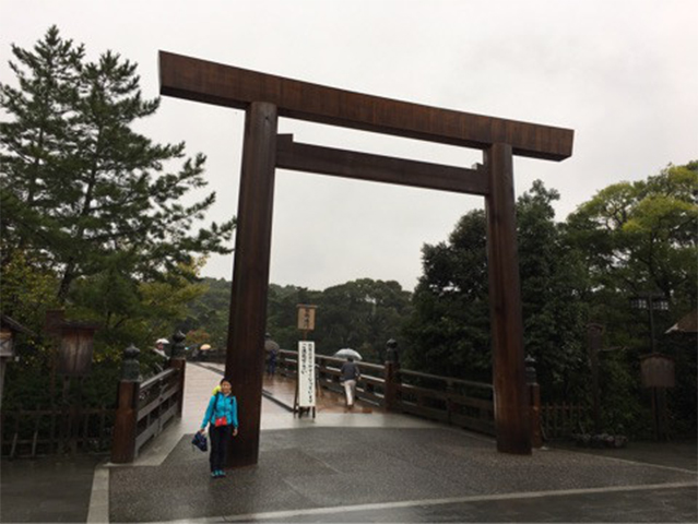
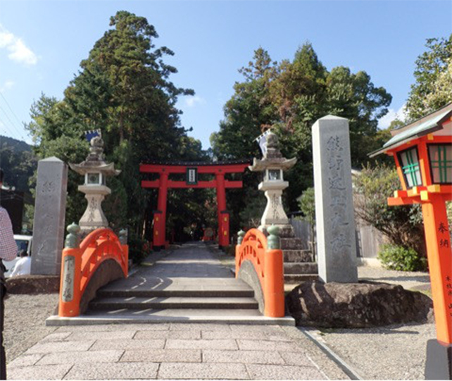
Worshiped at Naiku.
A large torii gate welcomed me at Naiku.
This is the start of my walking trip!
- 9:00
-
Oharai-machi & Okage Yokocho
I had to go to Oharai-machi & Okage Yokocho anyway!
Discovered a store that dealt in many cute goods!
I casually dropped by a dried fish store, too. Next was an Ise soy sauce store. (I wondered how many souvenirs I would buy from the first day...)
Speaking of Ise, the main store of Akafuku-mochi Co., Ltd. is MUST visit!
Another must-eat sweet here is Hemba-mochi.
I wonder if people in olden days got the power to walk by eating ohere, too?
It must be the time to start walking seriously.
- 11:00
-
Headed for Geku from Naiku of Ise Jingu
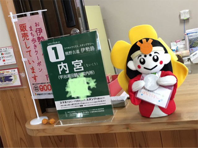
After passing the Okage Sando route (underground passage) of Naiku, I got a stamp at Uji Urata Tourist Information Center!
If I successfully collect all the Ise-ji Route stamps, I will get a memento! So, I decided to collect them.I stopped by Sarutahiko Shrine, and was given a charm for my safe journey along the Ise-ji Route.
I went to Furuichi, an amusement quarter which was very prosperous in the Edo Period.
I learnt about the history of Furuichi at Ise Furuichi Sangu-kaido Museum. With stone monuments that indicate the former sites of theatrical performances and a red-light district, visitors can think of the past.
- 12:00
-
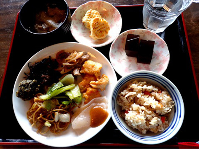
Worshipped at Geku, and had a lunch
After crossing over the Seta River, I was near Geku.
Arriving at a point in front of Geku, I got the second stamp at a tourist information center!
After that, I paid a visit to Geku. With beautiful greenery, Geku is relaxing.
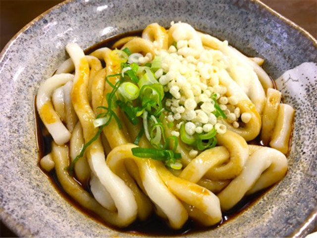
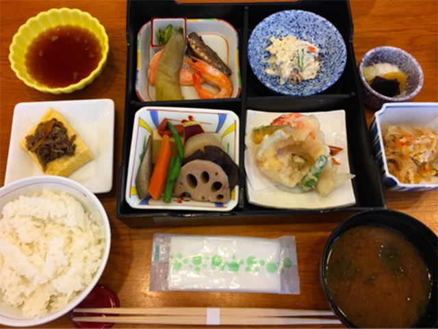
I had a lunch at a cafeteria nearby. Of course, I ate Ise udon.
It was delicious with the nicely soft texture of the noodles.
- 13:00
-
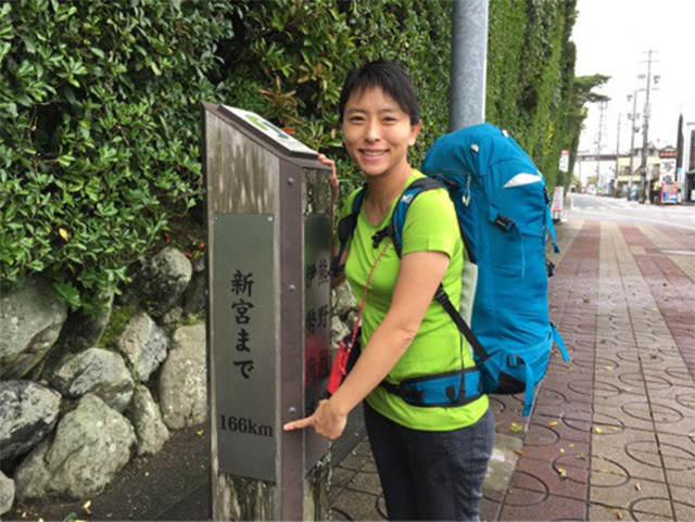
Headed for Tamaru from Geku.
When I got back to the Ise-ji Route, I found a road sign that guided me along the route to Shingu, the final destination of my journey at this time.
It was as long as 166 km to go from here to Shingu. Still far to get to my destination.
Passing a shopping street that retained the atmosphere of the Showa Period, and going up to the Miyagawa River bank, I walked along a cherry tree-lined road.
After crossing Wataraibashi Bridge over the Miyagawa River, which was crossed by a boat in olden times, I went down a road, which retains an atmosphere of an old road.
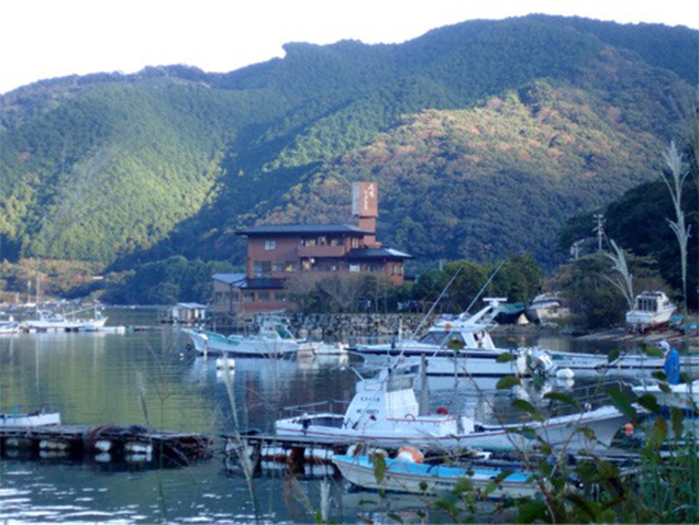
And after passing a railroad crossing of the Sangu Line, I arrived at today's destination, Tamaru!
- 16:00
-
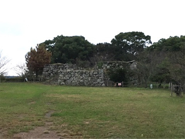
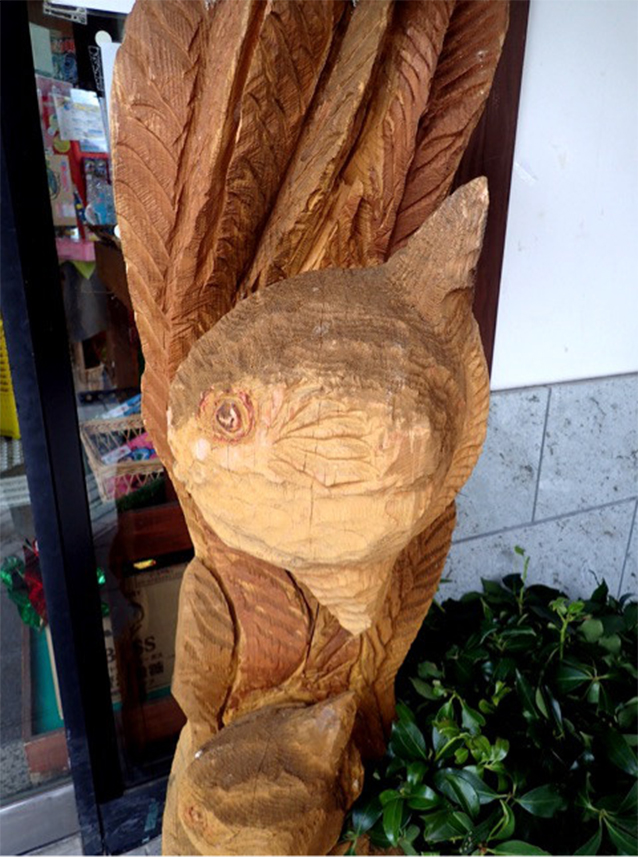
The former site of Tamaru Castle.
I deviated from the Ise-ji Route to head for the former site of Tamaru Castle, which is said to have been built in the period of Northern and Southern Courts (Japan) (1336-1392).
The beautiful stone walls, which were constructed with piled-up field stones, are said to have been built in the Sengoku Period (period of warring states) (Japan) by Oda Nobukatsu (a son of Oda Nobunaga.)
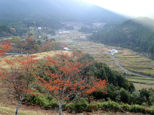
When I reached the former site of the castle keep, I was able to look out over the route that I walked along today.
The view that I saw behind me was a route I will walk tomorrow.
- 17:20
-
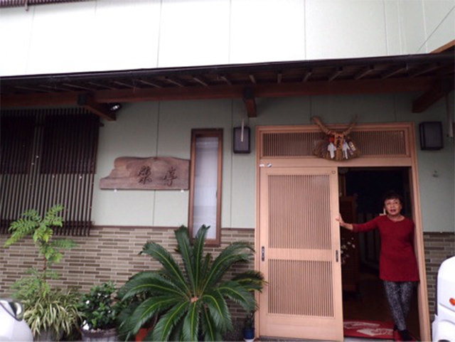
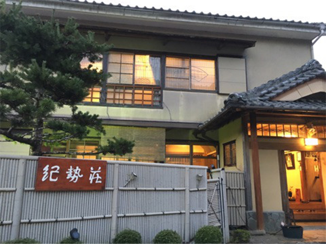
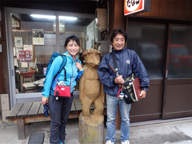
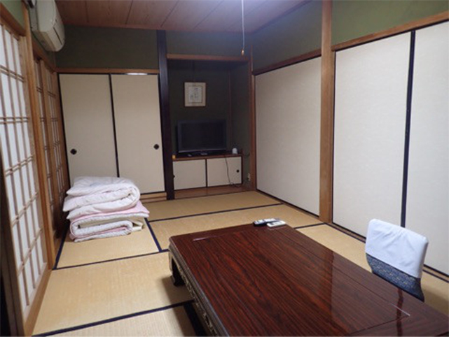
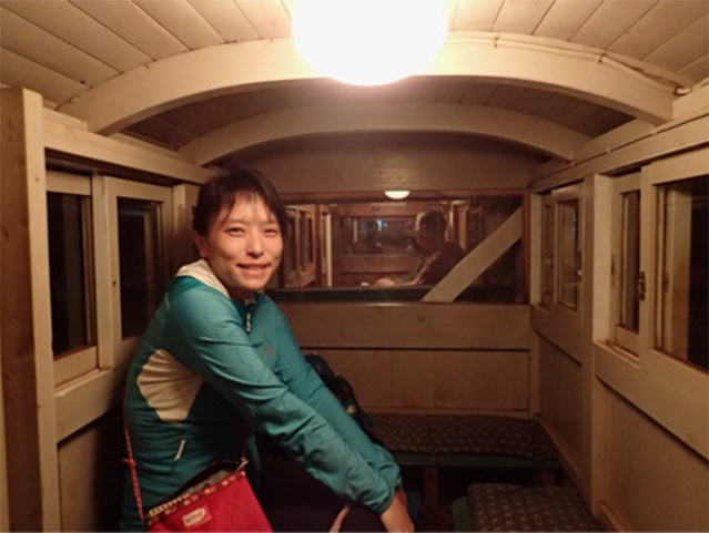
Sakaetei
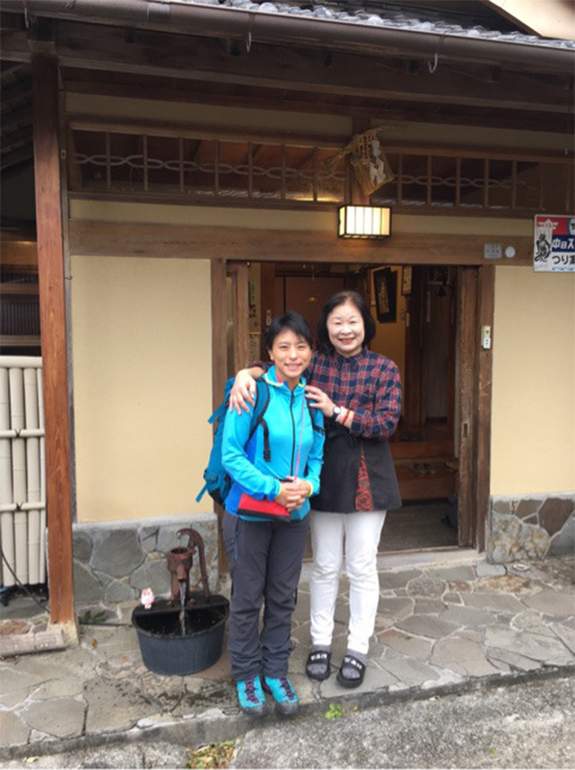
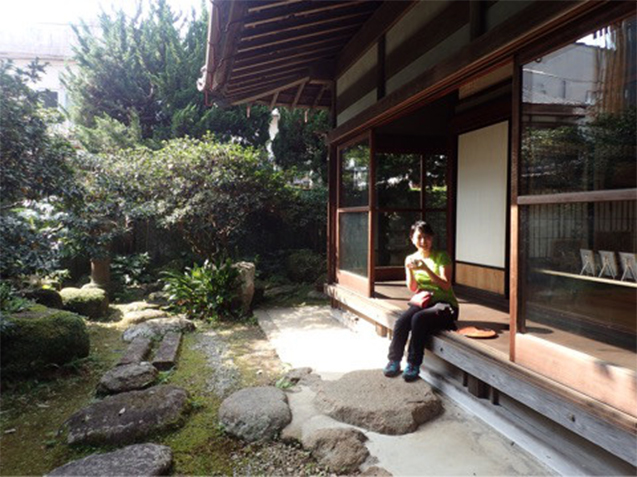
My accommodation on the first day is Sakaetei, a traditional inn which is located near Tamaru Station. Visitors can learn a lot about the courses ahead along the Ise-ji Route from the female master of this inn, who said that she walked through the entire Ise-ji Route in 2014, the year of the 10th anniversary of Kumano Kodo Pilgrimage Routes being listed on the World Heritage List.
Despite its simple facilities, this inn is comfortable.
Well, what will wait for me during my journey tomorrow? To be continued on the Day 2.
Day 2Tamaru - Taki-cho Distance of approximately
19.5km
- Walking distance:
- Approximately 22.5km
- Activity time:
- Approximately 7.5hours
- ※The walking distance is based on the GPS log. The distance includes the total distance of my side trips in this section, and is different from the actual distance between the starting point and the destination.
- ※The activity time includes not only the walking time but also lunch time, rest time, and hours of stopping over.
- 8:00
-
Left Sakaetei
I began walking along Ise-ji Route from a point in front of the inn's entrance.
- 8:00
-
Headed for Taki from Tamaru
Following the old road, I crossed over the Tokida River, and headed west along Prefectural Route 13.
After walking for a while, the statue of Settai Jizoson (Jizo of entertainment) which, according to a legend, was buried underground and was dug out after appearing to a villager in a dream, welcomed me.
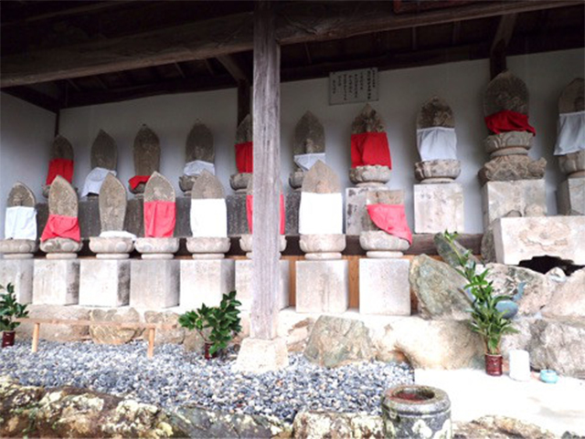
Viewing persimmon fields and cabbage patches, I went to Sekibutsu-an, in which 33 Jizo stone images stand side by side. Since this is said to be a place where travelers offer prayers for safety, I prayed devoutly.
After visiting Kuchira Shrine, one of Ise Jingu's auxiliary shrines, which appears like a forest floating in the middle of a paddy field, and enshrines the deity of farming; and Eisho-ji Temple in which old stone pagodas stand in a row; as well as Nishitokida Shrine in which names of deities are on a wooden board side by side, I went back to and walked along the Ise-ji Route again.
- 11:00
-
Magonomise Restaurant
I went to Magonomise Restaurant which is located about 1 km west of Tochigaike pond along the Ise-ji Route.
The restaurant is operated by students from the Culinary Course of Mie Prefectural Ohka High School doing everything from devising the menu, preparation of dishes, and entertaining guests, and is also well-known as a model for the drama “Kōkōsei Restaurant” (lit. “High School Student Restaurant”). The restaurant is so popular that it fills up quickly. I had “Hanagozen,” the most popular menu item of this restaurant. Every item of this menu item was delicious, like the ones served in a kappo restaurant (a type of a restaurant that offers Japanese cuisine).
- 13:00
-
Meki-toge Pass
After walking along Prefectural Route 119 for a while, I was quite near to a mountain.
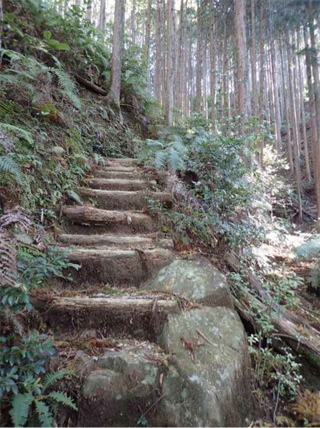
I arrived at the approach of Meki-toge Pass, the first pass of the Ise-ji Route. The time to go over the pass had come.
After getting a stamp at a guide board, I began climbing up the mountain.
The route was rutted, because not only people but also carts once followed it.
In the upper section of the pass, a sunken road remained, which was made by cutting out solid rocks, as well as stone monuments and stone Buddhist images, which have watched over travelers crossing over the pass.
Megi-toge Pass is a small pass with an elevation difference less than 100m and a distance of approximately1.8km.
I walked through the pass leisurely taking about 40minutes. Finally, it has become like walking along the Kumano Kodo Route.
- 13:40
-
Headed for Tochihara from Odai-cho
After crossing over the pass, I found a thatched-roofed Japanese restaurant called "HINAKAYA" beyond a tea plantation. Beyond a wonderful room with a glass-enclosed fireplace was the flow of the Miyagawa River.
This restaurant is operated by a store famous for its ayu-no kanroni (sweetfish boiled in a syrup) called "Uosuke".
It must be worthwhile only to see Restaurant HINAKAYA's thick thatched-roof. Please visit the restaurant.
I returned to the Ise-ji Route, and walked along the old road from the restaurant.
Although I compared my height with a tall stone image of Jizo, which was as tall as 150 cm, I forgot to take a picture of that with my camera.
There was a guide board for Joho Hoshi Gorinto (five-ringed pagoda for Monk Joho) standing at the road junction with Prefectural Route 709.
It is said that when an infectious disease was prevalent in this area, Monk Joho sought the help of Buddha by being buried alive so that the epidemic would be suppressed.
- 14:00
-
Yanagihara Kannon Senpuku-ji Temple
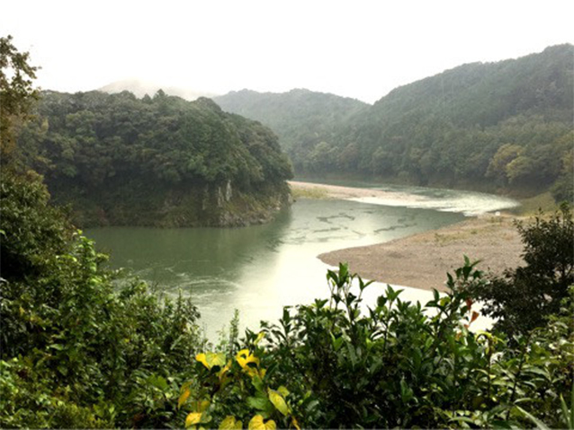
I returned to the old road, and visited Yanagihara Kannon Senpuku-ji Temple, whose principal image of Buddha is of Kanzeon Bosatsu (Buddhist Goddess of Mercy) which is said to have been created by Prince Shotoku. When I went to the inner part of the temple, I got a clear view of the Miyagawa River!
I heard that this is the only place to see the river greatly meandering. It was a view too wonderful to just pass by.
- 14:30
-
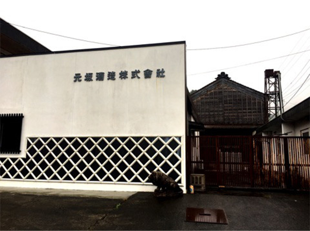
Gensaka Sake Brewing Company
Walking along the old road, travelers will find Gensaka Sake Brewing Company, a company which was founded in 1805. On this day, an executive director, who is a son of the seventh, took me on a special tour at their sake brewery.
My tour at the brewery started.
Gensaka Sake Brewing Company engages in brewing sake using subsoil water of Miyagawa River that runs through this area as its preparation water, and a valuable variety of sake rice called "Ise-nishiki." I was allowed to see the malting room and fermentation tanks, and to taste malt. It was Yamahai Junmai-shu (sake made without adding alcohol or sugar and using a method of yeast-mash making) of the company’s most famous brand, "Sakaya Hachibei," brewed from Ise-nishiki, which I finally selected after I was quite at a loss as to which one I should buy and bring home as a souvenir.
According to the brewer, this sake was offered as an aperitif for the lunch of the G7 ISE-SHIMA SUMMIT, which was held in 2016.
This sake should go well with the ayu-no kanroni that I bought earlier. I want to drink it as soon as possible!
Oh, I stopped by on my way to the destination again!
- 16:30
-
Okajimaya
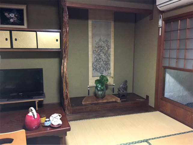
After crossing the Kisei Main Line in the Tochihara Station area while going along Prefectural Route 709, I arrived at a traditional inn called "Okajimaya".
According to the inn, it takes only one day for a good walker to get here from Ise.
The guest room has the air of nostalgia for the Showa Period, and is soothing. In contrast, the newly repaired lavatory and bathroom are very comfortable. Also with a free Wi-Fi environment, the inn seems to have welcomed guests from overseas countries positively.
The dinner was hand-made dishes that have been cooked with seafood and ingredients from the mountains.
Thinking that a walking journey is truly good, I appreciate that this day has also become fulfilling.
Day 3Misedani - Odai-cho
(Skipped walking due to a typhoon.)
- ※Due to a typhoon approaching, I traveled by an automobile to my destination today and changed my schedule to visit peripheral facilities, giving priority to securing safety.
- ※Please see the special episode for the schedule of the Day 3 of my journey.
- 9:00
-
Left Okajimaya.
I originally planned to walk to Misedani today, but had no choice but to skip walking because we had heavy rain from the morning due to a typhoon approaching.
I decided to head for Misedani, the destination of my journey today by car. It was very fast to travel by car...
- 9:30
-
Okuise Odai
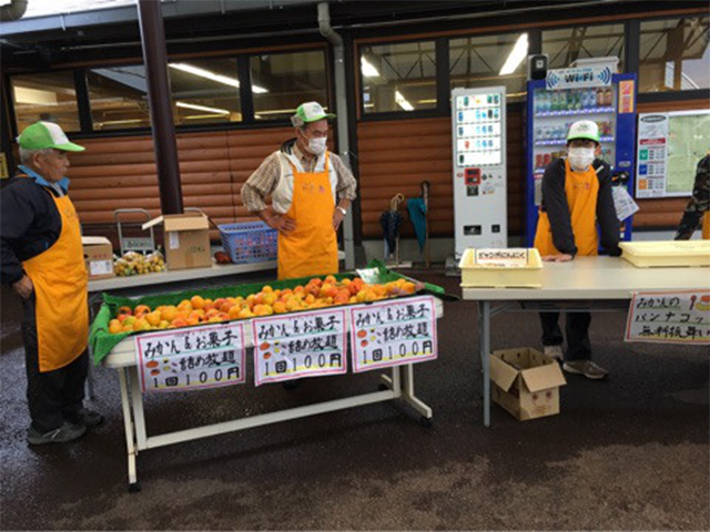
Roadside Station Okuise-Odai is locaed near Misedani Station.
There were many mochi products, specialties of Okuise, sold at the specialty sales corner.
Tempted by a sign that read “free food served,” I went to a stewed potato party held at the Waiwai Square.
I was entertained with a stewed hot pot hand-made by local ladies, and pannacotta with mandarin orange in it.
Next to the "free food served," unlimited packing of mandarin orange was offered for merely 100 yen per try!
Using the strategy of packing oranges alternately, I got eight mandarin oranges!
When I was thinking that I gained profit, a man in charge of the unlimited packing gave me as many as two extra mandarin oranges.
Roadside Station Okuise-Odai seems to hold a free specialty food serving event monthly.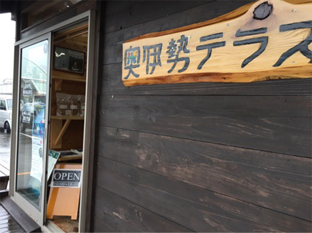
At a fancy shop "Okuise Terrace" which is an annex of the roadside station, aromatic water and essential oils extracted from trees grown in Odai-cho, such as hinoki cypress, Lindera umbellate, and Magnolia salicifolia, are sold.
- 11:30
-
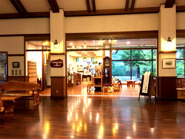
Okuise Forest Pia
Wondering that it must be good to relax at a spa on a rainy day, I visited Miyagawa Spa, which is located in a resort facility called "Okuise Forest Pia."
Forest Pia was a beautiful building constructed using a lot of wood.
The spa was a so-called sodium bicarbonate spring, filled with greenish water. I rested well, soaking in the hot spring.
I had a smorgasbord lunch at Forest Pia. The hand-made dishes there were delicious.
At Forest Pia, with the facility's BBQ Garden and cottage, visitors can have a relaxing time while enjoying nature around Miyagawa River. It must be good to stay there in a season from spring to summer.
- 15:00
-
Headed for Manei Ryokani
In preparation for my schedule tomorrow, I went back to Misedani Station, and stayed at Manei Ryokan.
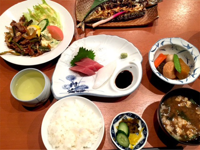
The dinner there included seafood, such as sashimi (sliced raw fish) and a cut open- and dried-mackerel pike, and stir-fried meat.
Eating so much delicious food, I have a strong presentiment that it's inevitable that I will get fat even after walking 170km.
To be continued on the Day 4.
Day 4Misedani - Misesaka-toge Pass - Ise-Kashiwazaki Distance of approximately
14.5km
- Walking distance:
- Approximately 26.4km
- Activity time:
- Approximately 7.5hours
- ※The walking distance is based on the GPS log. The distance includes the total distance of my side trips in this section, and is different from the actual distance between the starting point and the destination.
- ※The activity time includes not only the walking time but also lunch time, rest time, and hours of stopping over.
- 9:00
-
Left Manei Ryokan.
Although it stopped raining, I delayed my schedule and left the inn around 9:00 because the wind was strong.
Leaving the walking between Tochihara and Misedani as my homework, I decided to go ahead anyway.
- 9:30
-
Takihara Shrine
Before entering Misesaka-toge Pass, I stopped over Takihara Shrine, the auxiliary shrine of Ise Jingu, Naiku.
This auxiliary shrine is said to have been constructed related to a legend which says when Yamato Hime no Mikoto was crossing over the Miyagawa River, Manako no Kami, the guardian deity of this land, helped her by telling an easy way to cross over the river.
- 9:45
-
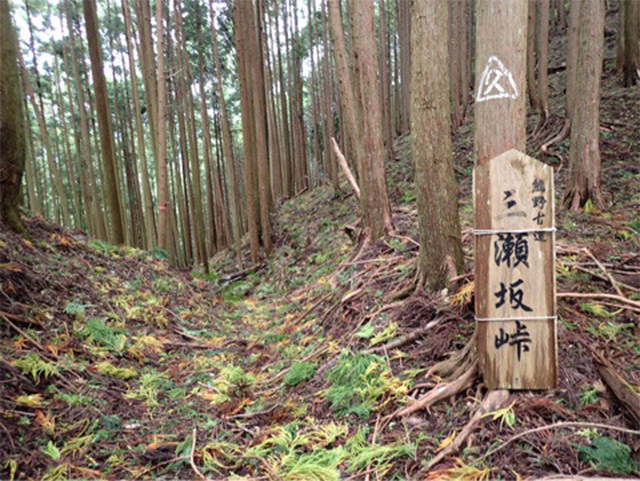
Misesaka-toge Pass
I went over Misesaka-toge Pass, the second pass in this journey. Walking sticks were prepared at the entrance of the pass.
I began walking up a slope while viewing tea plantations.
After walking along an unpaved forestry road for a while, I was at a mountain path.
The mountain path had become like a stream due to rain that had kept falling until the day before, and there were many Japanese freshwater crabs there.
After crossing over Misesaka-toge Pass where a Horeki Jizo statue was enshrined, which is said to have been created in 1756 in the Horeki Period, I was at National Route 42.
- 11:00
-
Takiharanomiya Shrine
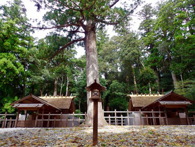
Walking along an old road running along a national road, I aimed for Takiharanomiya Shrine.
I heard that Amaterasu Omikami was once worshipped at this shrine temporarily before the deity was decided to be enshrined in Ise Jingu, Naiku. That's why this shrine is also called Moto Ise, isn't it?
In this shrine, two identical shrine buildings stand on the left and right sides of a huge cypress tree at the center.
On the right side of the cypress tree is Takiharanomiya Shrine and on the left side is Narabinomiya Shrine.
These shrines still enshrine Nigimitama (spirits of peace) and Aramitama (wrathful spirits) of Amaterasu Omikami, respectively.
- 12:00
-
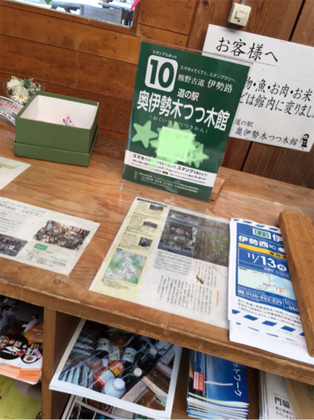
Roadside Station Okuise Kitsutsuki-kan
After visiting Takiharanomiya Shrine, I got a new stamp at Roadside Station Okuise Kitsutsuki-kan nearby!
I had lunch there.
The roadside station was equipped with toilets, and was very convenient for a walking trip.
Let's go back to the Ise-ji Route, and go ahead!
- 12:50
-
An old private house cafe
Since many old buildings, which are rare in these days, are left along the Ise-ji Route, finding them now makes me excited.
I have just discovered a cute sign! Is this for an old private house cafe? Seems interesting....
So I decided to have a hojicha tea pudding which was made from milk, eggs, and hojicha tea produced in Mie Prefecture as dessert for the lunch.
According to the cafe, it also offers lunch, and uses tableware from the Meiji Period for its dishes.
They also said that the building was constructed 130 years ago. It was a lovely cafe with a relaxed atmosphere.
-
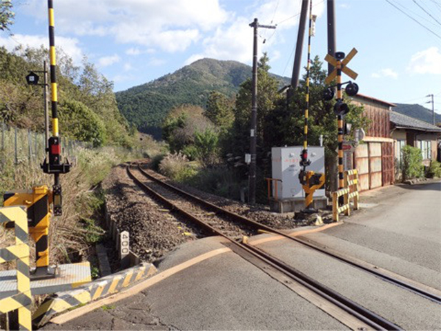
Kisei Main Line
After crossing the Kisei Main Line, I wondered what a simple railway track it was, and realized that there was no overhead wire along this line.
I heard that trains are powered by a diesel engine, rather than electricity.
What do we call the state of using no electricity as the motive power?
- 13:40
-
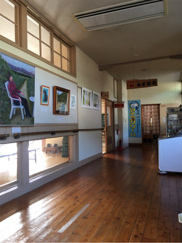
Asoyu no Sato
This is a hot spring facility that is operated by Taiki Town and reuses a building, which once was an elementary school, by renovating it.
It was interesting to feel the atmosphere of corridors and classrooms of the old elementary school.
Hot spring water felt smooth with almost no aroma or color.
If I take a long bath, it would be so difficult to walk afterwards. I took a quick bath instead. I was able to wash off the sweat and be refreshed!
It is also good to soak in a hot spring on my way to the destination, isn't it?
- 16:00
-
Daiko Shrine
Also in Yanahara Park, I found toilets. Beyond the park was Daiko Shrine.
Since visitors can embrace a serene atmosphere unique to this shrine, I recommend that you stop at this shrine, if you have time.
Here, Imperial Prince Koretaka is enshrined as the main deity.
Imperial Prince Koretaka is a son of Emperor Montoku, and an interesting person from the early Heian period, who is said to have the progenitor of kijishi (woodturners). I wonder why the prince is worshiped in this land.
- 16:40
-
Sankai no Sato Kisei
I stopped over Sankai no Sato Kisei, and got a stamp.
Here, visitors can purchase various marine products, such as half-dried bonito, and cut-open and dried saury.
- 16:50
-
Dairen-ji Temple
I reached the Kashiwazaki Branch of Taiki Town Office.
A weeping cherry tree here was wonderful. I hoped to come back to this place in spring again to see this tree.
Although my today's accommodation Kiseisou was near, I stopped over at one more place—Dairen-ji Temple, which is known as a temple of flowers.
I saw toad lilies blossoming. Visiting the main temple building, I took a quick rest.
- 17:15
-
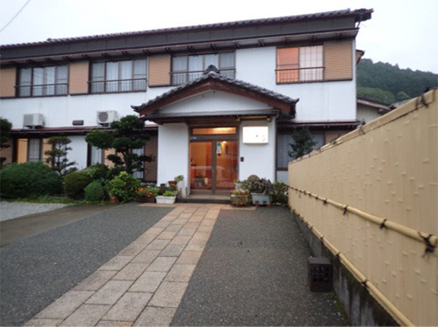
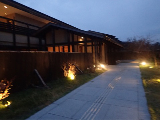
Kiseisou
This accommodation had a nostalgic feel created with corrugated sheet glass windows and window frames with round corners, and was spic-and-span, because every area had been well cleaned.
All I ate there was delicious seafood dishes.
The landlady of Kiseisou Ryokan was a very friendly (chatty?) person, who entertained travelers like a mother. The landlord was also a good-minded man.To be continued on the Day 5.
Day 5Ise-Kashiwazaki - Furusato Distance of approximately
26.0km
- Walking distance:
- Approximately 30.0km
- Activity time:
- Approximately 9hours
- ※The walking distance is based on the GPS log. The distance includes the total distance of my side trips in this section, and is different from the actual distance between the starting point and the destination.
- ※The activity time includes not only the walking time but also lunch time, rest time, and hours of stopping over.
- 7:00
-
Left Kiseisou
Being seen off by the landlady, I vigorously departed!
Today, it will take many hours to get to the destination.
- 7:00
-
From Ise-Kashiwazaki to Kii-Nagashima
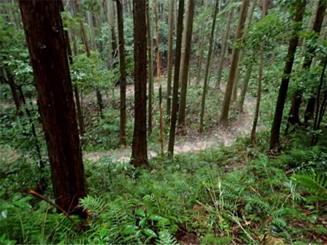
After walking along a road by the Kisei Main Line and the Kisei Expressway, along a trail through a cryptomeria forest, and along a riverbank of Ouchiyamagawa River, I was on a mountain path.
Following red taps, I crossed a wooden bridge called "Ashidani Bridge," and went back to the old road again after crossing National Route 42 at a point beyond the sign for Ouchiyama Zoo. After walking ahead for a while, I was at Ouchiyama Station.
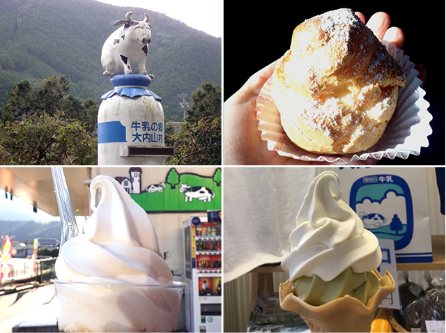
While walking from National Route 42, I found a monument of a cow standing (?) or sitting on a milk bottle.
Speaking of Ouchiyama, milk must be associated with it!
Although products most recommended by Milk Land, which is popular among local people, were vanilla soft ice cream with brown sugar agar and cream puffs, I realized that I forgot to drink the all-important beverage of Ouchiyama Milk.
- 8:40
-
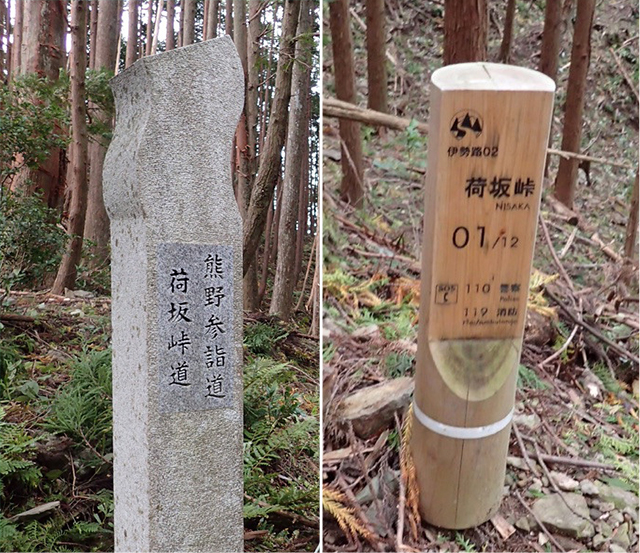
Nisaka-toge Pass
After the Ise-ji Route branched off to Nisaka-toge Pass and Tsuzurato-toge Pass at a point after the cow monument, the two passes converged again at Kii-Nagashima.
I decided to follow Nisaka-toge Pass, which was located on the border of Ise Province and Kii Province, and which began to be mainly used in the early Edo Period, rather than Tsuzurato-toge Pass, the old main road when Kumanokodo Roads were developed.
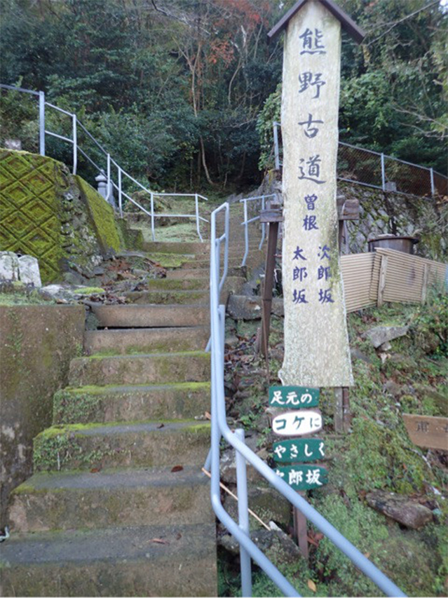
Then I finally got into the World Heritage zone!
I heard that there are stone monuments along Kumano Pilgrimage Routes which were registered on the World Heritage List.
Along the pass, which was designated as a World Heritage site, there are also signposts standing every 100m.
These signposts were very convenient because walkers can learn about their current destinations with such an indication as "01 / 12" which means that the total length of Nisaka-toge Pass is 1.2km and that you are now at a point 100m from the starting point.
With almost no rising slopes, Nisaka-toge Pass is mainly downhill, and easy to cross over.
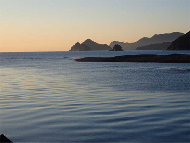
On my way to the destination today, after taking a right path and going up the path a little, I was in Okimidaira from which I was able to see the ocean, as the name of "Oki (offshore)-mi (see)-daira" indicated.
This had also been the first ocean I saw since I left Naiku (There are many first things to do at Nisaka-toge Pass.)The ocean is close!
There were two types of roads—One was a Meiji-style road, which was gently sloping so that a cart can follow, and the other is an Edo-style road which was a steep slope nearly running up to the top directly. Since I decided to follow the Meiji-style road, I was able to easily go over the pass, and reached a forestry road.
I heard that, along the forestry road, there are stone fences called "shishi-gaki" which were created in order to prevent animals from ravaging the fields, and which can be seen in many places along the course ahead!
- 12:40
-
Had a lunch at Roadside Station Kiinagashima Mambo
After walking for a while, I arrived at Roadside Station Kiinagashima Mambo.
I wondered why Mambo, but Kiinagashima seems to have a culture of eating sunfishes ("mambo" in Japanese).
One of my purposes of traveling along the Ise-ji Route is to learn about the culture of this land.
Sunfishes are cute, but I had no choice but eat them here, and it was a time to have lunch.
So, I ordered a set meal of a fried sunfish.
Mambo was a whitefish with simple taste.
After I thankfully ate mambo, I decided to go to a pier located ahead of the back of the roadside station.
Along the road to the pier, I was able to walk while viewing Katagami Pond.
- 13:30
-
Walking in Uomachi
Following the pier, I found a fancy cafe with an ornament of a kappa.
Mr. Ueda, the master of this cafe, seems to have been born in Uomachi, and is also a guide of the town.
I went to Uomachi on foot, and joined Mr. Ueda. Let's go on a guided tour in Uomachi!
The first place we went to was Enoura Ohashi Bridge, which had a wonderful view. Wow! the town is crowded with houses!
The town seemed to have been prosperous as a fishing village to a degree that it had several movie theaters.
After visiting Enoura Bridge at Nagashima Port (vertical-lift bridge), which moves upward only when a ship travels, and Bukko-ji Temple, which has Tsunami Ryushi-tou, stone monuments for victims of tsunami, I headed for a rest stop, which was built in Taisho Period as a public bath.
At the rest stop, visitors can enjoy a shadow play of a local old tale called "Kankara Koboshi to Jirozaemon" which is a story about punishing a kappa (imaginary creature) who makes trouble.
I see. That's why there was a kappa monument in Mr. Ueda's cafe!
As to what kind of relationship the man living in a place across from the rest stop has with the old local tale, wait and see when you actually visit Uomachi.
I cried out, "Incredible!" out of extreme amazement and emotion (smile).
Despite a short stay, it was a great strolling around the town of Uomachi guided by a local person.
- 14:30
-
Headed for Furusato from Kii-Nagashima
After parting with Mr. Ueda, I further walked ahead along the Ise-ji Route.
Walking along National Route 42 for a while, passing by a shipyard (Nagashima Dockyard), going across a railway crossing, I was at the approach of Ikkoku-toge Pass.
A stone Jizo statue with a cute round head welcomed me.
This pass can be crossed over quickly, because it is short with a small difference in height.
- 16:30
-
Kii no Matsushima
Extravagantly, I stayed in a detached room of Kii no Matsushima, a traditional inn located in the village of Furusato.
Meals here were very delicious.
Dishes of rare fish, such as Hilgendorf saucord boiled with soy and sugar, and deep-fried Lagocephalus puffer fish were lined up on the dining table.
Although this inn was equipped with a bath, using this opportunity, I went to Furusato Onsen, a bath house a few minutes-walk from my accommodation.
Even with a plenty of walking all day, if I have a delicious meal, get warm in a hot spring, and sleep soundly, I will become restored the next day!
Day 6Furusato - Miura-toge Pass - Hajikami-toge Pass – Aiga Distance approximately
16.0km
- Walking distance:
- Approximately 22.5km
- Activity time:
- Approximately 7.5hours
- ※The walking distance is based on the GPS log. The distance includes the total distance of my side trips in this section, and is different from the actual distance between the starting point and the destination.
- ※The activity time includes not only the walking time but also lunch time, rest time, and hours of stopping over.
- 9:00
-
Left Kii no Matsushima.
I left my accommodation energetically also today!
In the morning, the landlady of Kii no Matsushima saw me off.
With delicious seafood and hot springs that warmed me, Furusato has become one of the places that I hope to visit again.
This day, I aimed for Aiga after following Miura-toge Pass and Hajikami-toge Pass, and walking through two World Heritage zones.
- 9:00
-
From Furusato to Ikkoku, Hirakata-toge-Pass and Miura-toge Pass
From around this area, I started to see mandarin plantations.
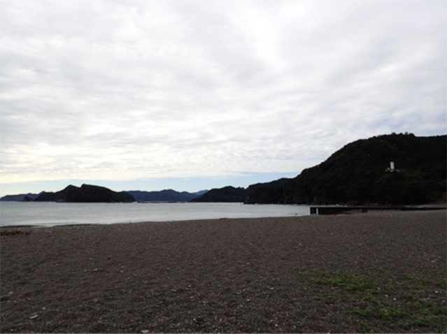
Before I started walking along today's course, I stopped over at a beach.
Unruffled waves were washing on the sandy beach. I heard that this beach turns into a popular seaside-resort in summer.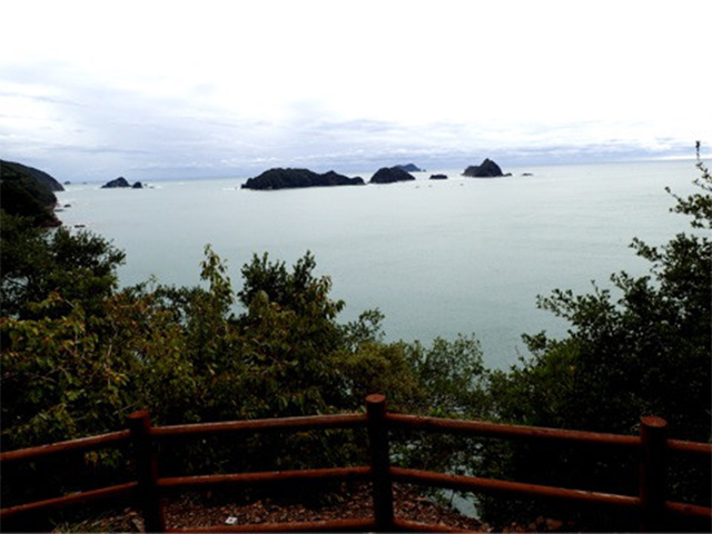
After walking a little along the National Route, and going onto a promenade just before Furusato Tunnel, I found the pretty Sabo Hanamichi Observatory.
From the observatory, I was surprised to see many islands floating on the sea!
Pillars of the arbor appeared like a picture frame. I wanted to spend a whole day here, reading a book.
After crossing a red bridge, I walked leisurely on a breakwater, while viewing the sea.
This beautiful place is Doze Beach. I understand why this place is called "Kii no Matsushima (Matsushima Island in Kii Province)."
After I left the beach, it was the start of crossing over the Miura-toge Pass.
At the approach of the pass, there was a guide sign with the distance, and the travel time written on it.
Miura-toge Pass was designated as a World Heritage Site, where a stone monument welcomes walkers.
Since the first of the signposts installed every 100meters indicates "1 / 18," the length of the pass is 1.8km. The pass is a deep sunken road with an altitude of 113 meters.
After going over Miura-toge Pass, I walked into the Minose district. With a few automobiles passing, I was able to leisurely walk in the village.
Stations in this area seem to be unmanned except for ones at which limited express trains stop. Minose Station was merely a small building as well.
- 12:00
-
Hajikami-toge Pass
After going across a railroad crossing, I was at the seaside. The surface of the sea was glittering with sunlight.
Dazzling and refreshing!
I entered Hajikami-toge Pass from a point ahead of this place.
The approach of the pass had been developed as Hajikami Sakura Square which were equipped with toilets and vending machines.
Seeing many cherry trees there, I wanted to walk along the pass also in spring.
Walking along a road behind the building of a hydraulic power station, I found one of the series of road signs, which have been installed every 4km.
The sign indicated that it was 82km to go to get to Shingu, and 84km to get to Ise. This meant that I had reached the midpoint of the Ise-ji Route!
I felt that it was so quick to walk half the route.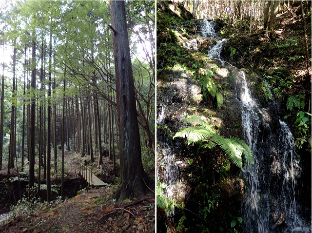
I began walking along World Heritage Hajikami-toge Pass.
Hajikami-toge Pass, which is known to be one of the scenic spots along the Ise-ji Route, extends for 1.6km.
Along this pass, I crossed bridges over streams many times.
I arrived at Hajikami-toge Pass at a height of 147m above sea level, and also got a stamp.
The scenery from the pass, which I had looked forward to seeing, was more wonderful than I had imagined.
Appearing in the sea around the peninsula with an intricate shape were many islands.
Probably because it was after rain, Hajikami-toge Pass impressed me as a pass with clear streams.
After going down the pass, going beyond Miyadani Pond, and walking along a non-designated road for a while, I arrived at the approach of the pass on the side of Umaze.
I found an arbor built in the garden of a private house where walkers crossing over the pass could take a rest, and decided to take a break, feeling thankful.
- 15:00
-
Aiga
I went onto the old road, and walked while viewing Ota Swamp on the left.
I heard that, in this area, cherry blossoms are beautiful in spring, hydrangeas in summer, and sazanka (Camellia sasanqua) blossoms in winter.
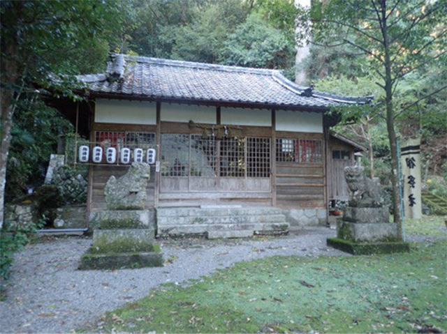
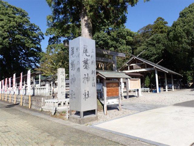
After crossing Okochi River, and passing by a stone Jizo statue located at the point I joined the old road, I stopped over Yaegaki Shrine.
This shrine had a Jingu yohaisho (place to bow in the direction of Ise Jingu).
Probably, people in olden days, when it was difficult to go to Ise, would have visited this shrine.
Ahead of this shrine was Miyama Museum, which is a fantastic Western-style building constructed in 1910.
The building used to be an annex of a private house, but is currently used as a local museum where articles from different times are displayed.
Above all, an article that particularly drew my attention was the "Records of Wolves." According to the museum, in the Edo Period, people who traveled along the Ise-ji Route were attacked by wolves.
Japanese wolves, which are now an extinct species, seem to have also lived in this land.
Oh! Today, I still have a long way to go.
I have to move forward! I got back to the old road and started to walk.
- 17:00
-
Minshuku Sasaki
After walking (or rather running) along the old road and the National Route, stopping over Aiga Shrine when it grew dusk after going beyond Miyama Interchange, I arrived at Minshuku Sasaki, an inn located by Lake Shiraishi.
I stayed at a room with an excellent view. A clear stream, the Choshi River, is also near the inn.
The story about the river is to be continued on the Day7.
Day 7Aiga - Magose-toge Pass - Owase Distance of approximately
12.5km
- Walking distance:
- Approximately 7.25km
- Activity time:
- Approximately 5.5hours
- ※The walking distance is based on the GPS log. The distance includes the total distance of my side trips in this section, and is different from the actual distance between the starting point and the destination.
- ※The activity time includes not only the walking time but also lunch time, rest time, and hours of stopping over.
- 6:00
-
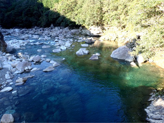
Choshi River
I got up early, and went to the mouth of Choshi River, which boasts the highest-class transparency in Japan.
One of the events I have looked forward to was seeing this river on my journey this time.
Because of the river water's high transparency, water in the river mouth area, where seawater and river water are mixed, becomes cloudy (yurayura) like a state of water when gum syrup is dropped onto it due to the difference in concentration. The area is called "Yurayura Obi (cloudy zone)." The name "Yurayura Obi" is also on the Google map.
Then I felt hungry. I returned to Minshuku Sasaki, had breakfast, and left the inn!
The inn's fish dishes were very delicious. In particular, the seafood gratin, served for dinner, was exquisite.
- 8:00
-
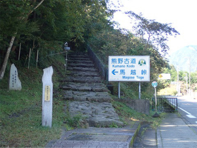
Magose-toge Pass
This day was the highlight of the first half of my journey. I walked along Magose-toge Pass.
Since I also went to Mt. Tengura, a mountain with an altitude of 522 m, it was mountain climbing, rather than walking along the Kumano Kodo route.
In the Road Station "Miyama" which is visited by many people who are crossing over Magose-toge Pass, there were various local specialties on the shelves. What I purchased was "Choshi-gawa no Mizu (Water of Choshi River)."
I would like to drink it while walking along Magose-toge Pass.
Then, Mr. Kawaguchi, who is a storyteller and who will guide me here at Magose-toge Pass joined me.
Nice to meet you!
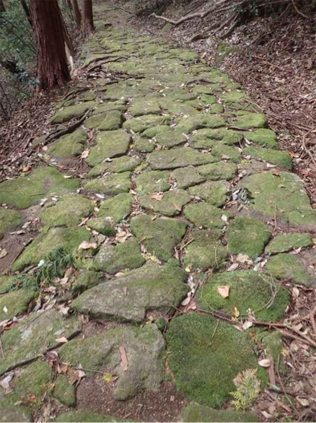
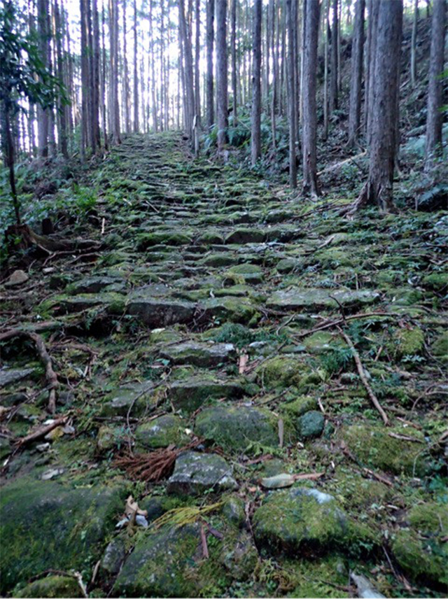
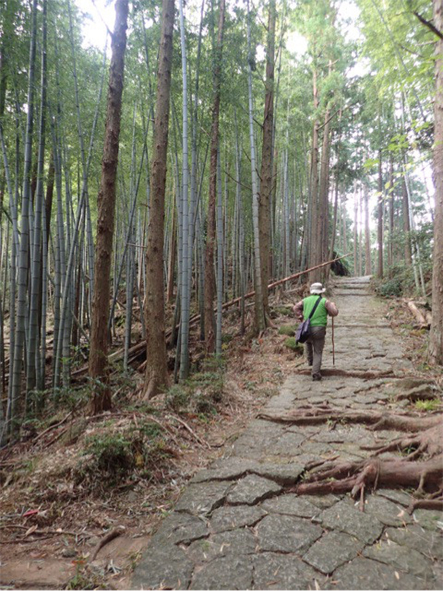
Magose-toge Pass is well-known for its beautiful stone pavements. I heard that these stone pavements were mainly created in the Edo Period.
Magose-toge Pass is 2.2 km long, the longest pass so far in my journey. However, with the stone pavements, the pass makes people walk with small steps, and is easy to walk along.
Magose-toge Pass, which has stone pavements, impressed me as being how I imagined Kumano Kodo pilgrimage routes.
I heard that the reason for creating such sturdy stone pavements was to prevent the road from being damaged by heavy rains in this land where much rain falls. What made me excited about Magose-toge Pass was that the geographical features of the pass have little changed from those depicted in Saigoku Sanjūsansho Meisho Zue, a large guide to Buddhist pilgrimage sites written in the Edo Period.
After that, I climbed Mt. Tengura, which is one of the marvelous viewpoints.
- 11:40
-
Mt. Tengura
Mt. Tengura is popular as a mountain with a great panoramic view located approximately 30 minutes south from Magose-toge Pass.
I had also learnt about the mountain before I came to the Ise-ji Route, and have looked forward to climbing it.
However, the course from Magose-toge Pass to Mt. Tengura is a series of steep uphill sections. Storyteller Kawaguchi accompanied me.
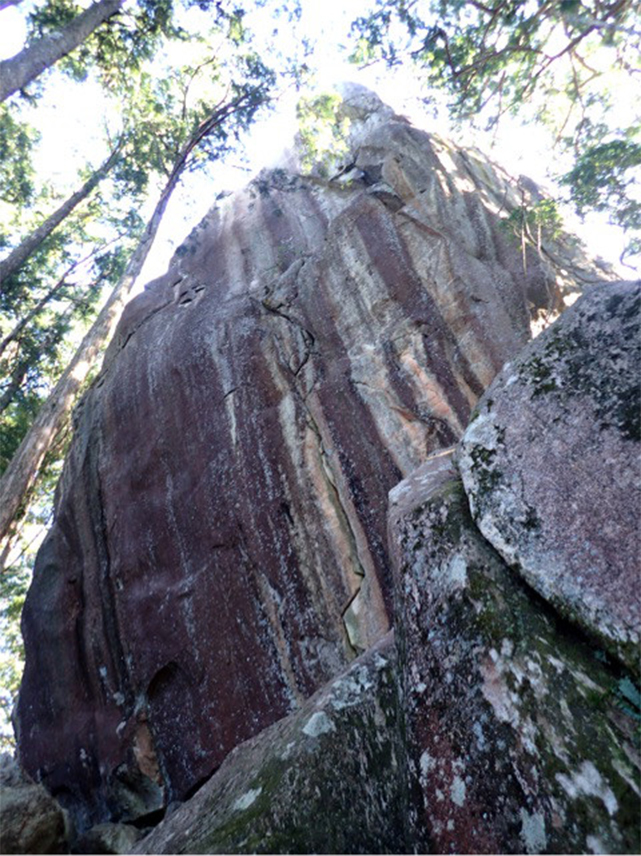
We took time to climb a steep slope, then a gigantic rock appeared. So spectacular!
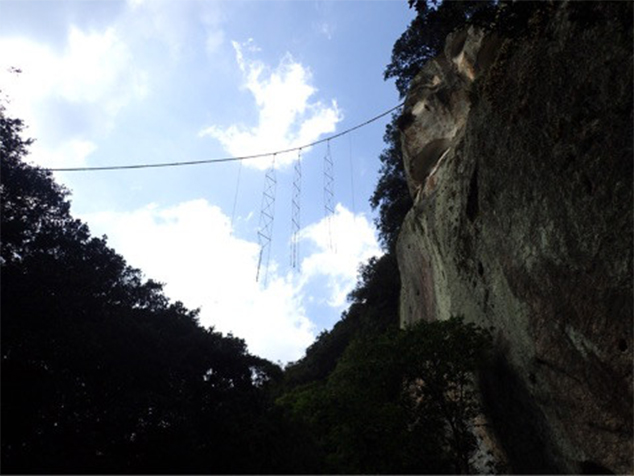
A huge rock with a nearly vertical ladder was before my eyes. After I climb up this ladder, I will be on the summit of Mt. Tengura.
Wow! this is it! I have finally come to Mt. Tengura which I have seen in pictures!
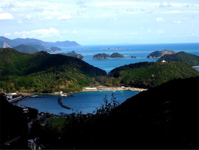
The view from the summit was beautiful with the cityscape of Owase and Owase Bay.
In fact, I hoped to visit Ochobo Rock, which is located at a point beyond Mt. Tengura as well as Mt. Binshi, which is situated on the north side of the Magose-toge Pass, but I would like to do that when I have another chance, because it feels that I will not arrive at Owase forever with that plan.
I enjoyed Magose-toge Pass, the highlight of the first half of my journey, very much.
- 14:30
-
Choshi River
After finishing crossing over Magose-toge Pass, I returned to Miyama from Owase, then Mr. Kawaguchi took me to the upper reaches of the Choshi River!
I was able to see "Choshi-gawa Blue," the incredibly beautiful blue water of Choshi River!
I believe that water there was clearer than that in the lower reaches.
I parted with Mr. Kawaguchi there. Thank you for letting me spend a pleasant day.
- 15:45
-
Owase
Owase Shrine was on the right side of the road when I entered from an exit of Magose-toge Pass, and at a point before I crossed over Kita River.
Although all the old records of the shrine, which were carried away by great tsunamis in 1707 and 1854, are unknown, the shrine is said to have already existed there around the year 700.
Next to Owase Shrine is Kongo-ji Temple.
Nio Gate was huge!
The history of this area as a prosperous city of forestry can also be sensed from the fact that the area has a large shrine and a large temple.
I heard that a trolley trail intended to carry timber ran through this area, and that there was a large warehouse.
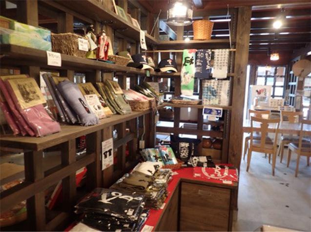
If you drop in the Owase Tourism and Local Products Association, you can get interesting pieces of tourist information.
Unfortunately, despite my aim to try all types, I was not able to eat any "Owase Bou," local specialties made into rod shapes, due to such reasons as stalls that offer these specialties being closed. (T_T)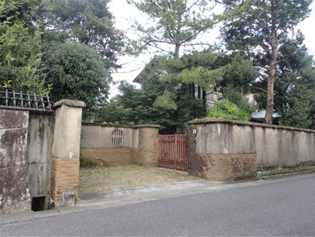
There were several old buildings left in the city of Owase.
Found along the Ise-ji Route was an intriguing house, which had exotic trees, probably palm trees, and a more intriguing style of the gate.
At the end of a very extensive wall of the house was another large gate.
On the map, the name of the house was "Doi Kodomo Kurashikan." I asked an old lady who I encountered there, "Who is the owner of this resident?" The old lady told me that it is owned by the Doi family who deals in timber.
According to the old lady, Owase has long had many companies that engage in forest management, and the Doi family was the top of them.
I was also convinced by the magnificence of the residence.
It was truly an interesting thing to see.
When I reached Owase, it was time for my journey to be temporarily suspended.
On the day after the day when I stayed at Hotel Mochizki, I returned home for work.
However, my journey along the Ise-ji Route continues.
Special episodeKumano Kodo Center and Yume Kodo Owase
- 9:00
-
Kumano Kodo Center
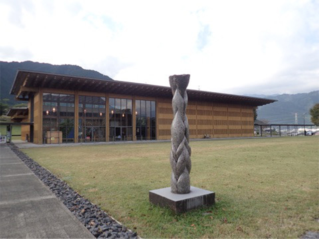
Before I temporarily returned home for work from Owase, I visited Mie Prefectural Kumano Kodo Center in Owase in the morning.
This is a visitor center that opened in commemoration of the registration of Kumano Kodo Pilgrimage Routes being registered on the World Heritage List, which is designed so that visitors can learn about Kumano Kodo routes through not only exhibition panels but also videos.
- 11:00
-
Yume Kodo Owase
After leaving Kumano Kodo Center, I visited Yume Kodo Owase, a bath facility which is located immediately north of Kumano Kodo Center.
This facility is equipped with a public bath called "Yumekodo no Yu" where visitors can soak in hot deep sea water, rather than hot spring water.
In the open-air bath, visitors can soak in both an acid bath and an alkaline bath.
In Yume Kodo Owase, the "Mom’s Lunch Buffet" is popular.
Here, visitors can enjoy simple dishes that use local ingredients in a smorgasbord style.
After I took a bath, and got full, I temporarily left the Ise-ji Route.
To be continued in the second half of my journey....
Special episodeTochihara – Misedani and Tsuzura-toge Pass
-
Although this is the start of the second half of my journey along the Ise-ji Route, I still have sections to walk along.
One is the section from Tochihara to Misedani, which I was not able to walk along on the third day due to a typhoon.
And the other is Tsuzurato-toge Pass, one of the passes along the road which diverges at Umegatani.
- 13:00
-
Tsuzurato-toge Pass
Tsuzurato-toge Pass, whose name is derived from the pass being winding (tsuzuraore in Japanese), is 1.8km long.
I climbed up the pass through a beautiful forest. which was not so tough.
This pass is also located on the border between Ise and Kishu.
Along Tsuzurato-toge Pass, visitors can see masonry walls created through the nomen ransou-zumi method (natural stone random masonry method) in order to prevent the road from being disrupted in an area with a geographical feature of a valley.
- 14:30
-
From Tochihara to Misedani
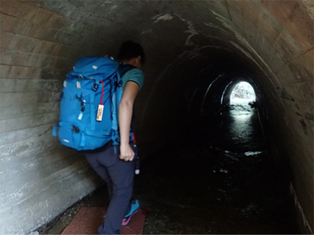
I returned to Tochihara by car, and walked along the section between Tochihara and Misedani which I was not able to walk along before due to a typhoon.
I heard that it is an interesting course with the road running through a deep valley. When I arrived at the approach of the valley, there was a tunnel.
At that time, since a stream ran inside the tunnel after rain, my heart was pounding as I tried to walk in the tunnel without my shoes getting wet. It's so interesting that Kumano Koso has such a place!
* When a large quantity of water runs in the tunnel, be sure to avoid walking there.
After getting out of the tunnel, I walked along the stream for a little while, and then entered an ordinary mountain path.
After entering the old road before Bakamagari Bridge and the entrance of a village called Kamize, I passed through a road along which four rare small shrines called "Tashu Shinshi" are enshrined, and entered Sarukisaka Slope. After walking through a bamboo grove, and crossing over a stream, I found a brick megane-bashi (a bridge with two semicircular arches).
When I got out of Sarukisaka Slope, I saw a sprawling tea plantation. Then Kumano Kodo road turned into a mountain path again.
Going further down the path after seeing a well called "Tonosama Ido," which is said to have been used by a tonosama (a lord) who came here for hawking to take a rest, I found a guide board for Ikidaore Bohi (literally, a gravestone for a person who was found dead by the roadside).
This is intended to pray for the souls of people who died before achieving their ambitions.
* Since the Ise-ji Route was blocked in this section due to the typhoon at the end of October, 2017, I used a bypass route.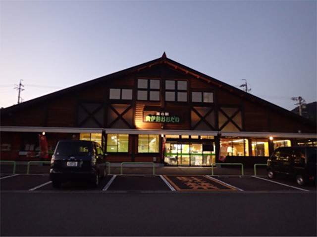
When it was getting dark, I arrived at Roadside Station Okuise-Odai.
Since I have come here, I finally completed the first half of my journey along the Ise-ji Route. Now I can go on to the second half of the course feeling refreshed.
Starting from the next story in Owase, please enjoy the stories of the second half of my journey.
To be continued.
Day 8Owase - Yakiyama-toge Pass – Kata Distance of approximately
15.0km
- Walking distance:
- Approximately 20.0km
- Activity time:
- Approximately 7hours 50minutes
- ※The walking distance is based on the GPS log. The distance includes the total distance of my side trips in this section, and is different from the actual distance between the starting point and the destination.
- ※The activity time includes not only the walking time but also lunch time, rest time, and hours of stopping over.
- 8:00
-
Departure
The second half of my journey started from the most difficult section in the Ise-ji Route in which I had to cross over Mt. Yaki (Height above sea level: 627m).
When I entered the Kumano Kodo route, I found one of the road signs installed every 100m, a type which I mentioned before.
The indication was “01/63.” The course for Mt. Yaki is as long as 6.3km, isn't it? I will walk energetically!
I heard that the stone pavements in this area are believed to have been laid in the Edo Period.
There were some Ikidaore Junreihi (grave markers for pilgrims who were dead on their way to Kumano) there.
According to the guide board, some pilgrims used up all their strength and lost their lives here in Mt. Yaki, the most difficult section to cross over in western Japan.
I powerfully went up the steep stone-paved slope.
After the first difficult section in which I walked along a zigzag slope, the slope continued winding for a long time.
However, seeing may stone Jizo statues placed along the roadside, I felt as if they were looking out for me.
After seeing a stone monument of Sakura Chaya Ichirizuka, and passing by the Renge Rock and the Eboshi Rock, I encountered stone Jizo statues again.
Every stone Jizo statue in Mt. Yaki has a friendly look.
After climbing up a steep slope again, I arrived at Kuki-toge Pass.
When I had hard time climbing up a slope, I took a short rest while praying to Jizo statues.
After climbing up the continued slope for a while, I found the former site of the tea house of Miki-toge Pass at a point immediately below the summit of Mt. Yaki.
Since the summit was directly above the former tea house, I was able to reach it.
The sign for the summit was at a point slightly off the road.
From the Sakura-no-Mori Square located beyond the summit, I had a clear view of the town of Kuki that is famous for the Kuki Suigun Navy, which played active roles in sea battles in the Sengoku Period (period of warring states). After leaving the Square, I went down Mt. Yaki.
At that point, although I had crossed over Mt. Yaki, I still had two passes to cross over: Miki-toge Pass and Hago-toge Pass.
I'll do my best to walk them.
- 13:00
-
From Mikisato to Miki-toge Pass and Hago-toge Pass
It was quite tough for me to go up and down the road with an altitude difference of at least 600m.
However, a good thing about a journey along the Ise-ji Route is that visitors can enjoy an expansive view of the sea after walking.
After crossing over Kutsukawa River, I walked around in the village of Mikisato.
I entered a mountain path called Yokone Road, which had been buried for a long time, but was excavated by local people in recent years to be passable. I got back to the National Route, and soon entered Miki-toge Pass. Despite its short length of 800m, this pass requires substantial walking.
I heard that since quite a tough series of courses to get over passes of Yokone Road, Miki-toge Pass, and Hago-toge Pass awaited travelers in olden days after going over Mt. Yakisan from Owase, they avoided this section, and sailed across the sea on a boat from Mikiura to Soneura.
In this area, extensive masonry walls continue along the road. It was like exploring around ruins from ancient times.
After passing a point that commands a view of the sea, I finally arrived at the approach of Hago-toge Pass.
It was a long way to get here. However, once you begin going up the hill, you will arrive at the pass soon.
After viewing Mt. Akiha at the exit of Hago-toge Pass, I further walked down the road, and found Katahane no Gorintou (a five-ringed pagoda in Katahane).
After I cross over the pass, Kata, my goal for today, will be right nearby.
- 16:10
-
Asuka Shrine
Asuka Shrine was located in the immediate vicinity of my today's accommodation.
This shrine is worth seeing, with many huge trees growing thickly.
The left tree of the photo is a camphor tree, and the right tree is a Japanese cedar tree. Both trees seem to be over 1,000 years old.
Since Yayoi potteries were excavated in this area, this must have been a place of prayer from ancient times. In addition, the area has large, splendid trees such as a set of four massive Japanese cedar trees. If you ever come up this way, be sure to look in.
- 16:30
-
Owase Seaside View
Owase Seaside View was an excellent accommodation with lovely views of the ocean.
Since the location of this accommodation is at the back of the inlet of the Kata Bay, despite being near the sea, the view from the accommodation is gentle like that of a lake.
Another good point of this accommodation was that dinner was carried to my room.
Moreover, I enjoyed a panoramic view in a large glass-plated bath.
Even though my feet are tired, I have spent some very fulfilling days.
Look forward to the story about the Day 9, too.
Day 9Kata - Nigishima - Atashika – Odomari Distance of approximately
20.1km
- Walking distance:
- Approximately 21.0km
- Activity time:
- Approximately 8hours 15minutes
- ※The walking distance is based on the GPS log. The distance includes the total distance of my side trips in this section, and is different from the actual distance between the starting point and the destination.
- ※The activity time includes not only the walking time but also lunch time, rest time, and hours of stopping over.
- 7:00
-
Departed from Owase Seaside View.
Going over Sone-jirozaka-tarozaka Pass, Nigishima-toge Pass, Oukamizaka-toge Pass, Obuki-toge Pass, and so on, I aimed for Odomari.
Today, I will have a series of mountain paths again!
- 8:30
-
Sone-jirozaka-tarozaka Pass
Sone-jirozaka-tarozaka Pass is a long pass of approximately 4km.
As for the name of this pass, which was on the border of Shima Province and Kii Province, it is said that people had argued saying, “This is my jiryo (territory) and that is taryo (other people's territory)” in the border area for as long as 1,000 years, and the pass was named after the argument having been corrupted into “Jiro” and “Taro.”
By the way, the pass is now on the border of Owase City and Kumano City.
After crossing over this pass I will be in Kumano, right?
I followed the mossy stone-paved slope of Sone-jirozaka-tarozaka Pass.
- 12:00
-
Nigishima-toge Pass and Okamizaka-toge Pass
The total distance of a course made by connecting these passes is approximately 3km.
I climbed up the stone-paved road which retains the atmosphere of Kumano Kodo road.
It is said that the Chinese characters of Oukami, which means “meet deities,” imply the meeting of deities of Ise and Kumano.
I headed for Atashika from Oukamizaka-toge Pass, going down the stone-paved road with powerful strides.
After going down the road in front of Koshin-san, I was on a beach.
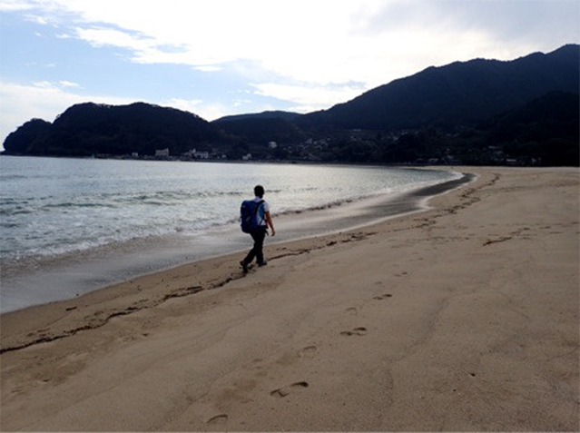
The beach I arrived at was Atashika Beach. The beautiful sandy beach with fine sand grains was spread out there.
I heard that Atashika Beach was an unexplored part of Mie Prefecture, and it was truly a wonderful place.
- 13:00
-
Hadasu
After leaving the sea, I entered the World Heritage Hadasu-no-michi Pass.
The stone pavements here was created by arranging round stones.
These are the oldest stone pavements along the Ise-ji Route from as long ago as the Kamakura Period (Some suggest that they are from the Edo Period).
The road, which was registered on the World Heritage List, is short at only 300m.
However, the atmosphere of the stone pavements is so fantastic that the road is worth visiting.
- 15:00
-
Obuki-toge Pass
The uphill road of Obuki-toge Pass starts from the point of a road sign.
Obuki-toge Pass is 1.4km long. I walked up the road beside a bamboo grove. Although the Ise-ji Route directly leads to Odomari after the pass, I turned right off the original Ise-ji Route at Obuki-toge Pass, and walked along Daikan Inogaki Road which led to Kannon-michi Pass so that I could follow Kannon-michi Pass, which has an excellent atmosphere.
After the end of Kannon-michi Pass, I walked along a roadway into the town of Odomari.
When I arrived at Odomari Station, I reached my goal for this day.
Although I was exhausted from walking along today's long course, I will stay at a truly wonderful accommodation today.
- 16:50
-
Resort Kumano Club
I stayed at Resort Kumano Club, an accommodation located about a 20-minute car ride from Odomari Station.
Resort Kumano Club is a lodging and tourist resort facility.
The floor of my room is made of Kumano cedar. What an excellent room I can use...
It's healing. Tonight, I will sleep with stretched out at full length!
Dinner was kaiseki ryori (a meal developed based upon the tea ceremony) made from ingredients which had been arranged from local produce.
While a dish called “Houhan,” which represented sacred sake and a meal for deities, reminded me of Ise Jingu, Naiku, the starting point of the Ise-ji Route, when komochi-ayu no heshiko (salted sweetfish with roe pickled in rice-bran paste) was served, I remembered how delicious the dish of sweetfish with roe was that I had on the first night of my journey in the Eitei Ryokan in Tamaru.
When I was eating fish from Owase Fishing Port, I remembered the view of Owase I saw from Mt. Tengura and the long uphill slope in Mt. Yaki.
While I appreciated the taste of each dish, it was as if I was following my journey along the Ise-ji Route so far again.
Probably, Resort Kumano Club must have been produced so that guests can follow the route. What a wonderful accommodation!
Steeping in the memories of my journey, I finished my meal, and went soaking in the hot spring.
I felt refreshed soaking in the expansive open-air bath there.
The next morning, I had no time to enjoy the morning view while drinking freshly-squeezed mandarin orange juice, so I instead bit off a crunchy open-cut dried saury, which was served for my breakfast, and left Resort Kumano Club at a little past 7.
The Day 10 will finally see the highlight of the second half of my journey. I will walk along Matsumoto-toge Pass.
Don't miss it!
Day 10Matsumoto-toge Pass - Oni-ga-jo - Hana no Iwaya Distance of approximately
19.0km
- Walking distance:
- Approximately 11.5km
- Activity time:
- Approximately 4hours 40minutes
- ※The walking distance is based on the GPS log. The distance includes the total distance of my side trips in this section, and is different from the actual distance between the starting point and the destination.
- ※The activity time includes not only the walking time but also lunch time, rest time, and hours of stopping over.
- 7:00
-
Left Kumano Club
After leaving Kumano Club, I came to the approach of Matsumoto-toge Pass.
Matsumoto-toge Pass is the last pass along the Ise-ji Route.
- 7:45
-
Matsumoto-toge Pass
On this day, I was taken on a tour of the pass by Storyteller Yamakawa.
Although the pass is not so long at 700meters, it is well-known as a road which still retains beautiful stone pavements along with Magose-toge Pass, which I followed in the first half of my journey.
For Matsumoto-toge Pass stones different in size are arranged so that they are combined with each other.
These beautiful stone pavements, which were created with old craftsmanship, remain largely unchanged even after many years.
Standing along the pass was a large stone image of Jizo as tall as 1.8m. When I took a closer look, I saw a round hole created at its feet.
A legend has it that on the day when the image was installed, Shinzaemon, who was a great gun shooter in the Edo and Genroku Periods, shot the Jizo with his gun when he entered the pass, mistaking it for a yokai (a ghost, a spirit, or a monster), because the image was not there in the morning.
Since this image is quite large, he must have been surprised.
Leaving Kumano Kodo road at the pass, we headed in the direction of an observatory.
There was an arbor at the observatory that commands a view of Shichiri-mihama Beach.
- 9:00
-
Oni-ga-jo
After going down Matsumoto-toge Pass, our plan was to walk around Oni-ga-jo. Before it, we took a short rest at Oni-ga-jo Center.
The center dealt in various local specialties and souvenirs that I have not seen so far.
The glossy black articles were Nachiguro stones.
I heard that people in olden days picked up these stones at places such as Shichiri-mihama Beach, and took them back home as proof of their pilgrimage to Kumano.
Currently, products are sold that were created by processing Nachiguro stone into ornaments and inkstones.
Mr. Yamakawa bought me Niihime Cider Float.
With tingling foaming feeling and sour-sweet taste, the beverage was delicious. Niiheme is a citrus fruit discovered by chance in Kumano City, and seems to be a hybrid between tachibana (wild orange) and Satsuma mandarin. It has a strong acidic taste and refreshing aroma.
As my thirst was quenched, we walked from here along the beach with precipitous cliffs for a while.
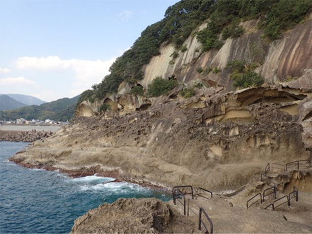
Oni-ga-jo is a queer landscape created by nature.
A promenade, which is an approximately 40-minute course going one way, was created by traversing the rock cliffs.
Along some roads running on top of precipitous cliffs quite high from the sea, there were some points at which I froze looking downward at my feet.
When I looked upward, the eroded rock was extremely powerful.
I heard that the current scenery was created by the rock being chiseled by waves and wind, and the later upheaval of the ground.
Oni-ga-jo was an interesting place.
- 10:15
-
Kinan Tour Design Center
After leaving the beach, we headed for the town of Kinomoto, and stopped over Kinan Tour Design Center.
The building of the Center was wonderful. This is a visitor center that uses a local village official's house built in 1887, where visitors can get the area's tourist information.
A Japanese house is truly relaxing, isn't it? I want to live in a house like this.
(Cleaning and maintenance of it must be dreadful, though.)
- 10:45
-
Kumano Kodo Omotenashi House
This is also a building that uses an old private house with its Japanese-style room used as a resting place.
As I thought, visitors can get various types of tourist information in facilities in Kumano City.
In this facility, visitors can purchase local specialties in the Kumano area, such as Japanese-style small articles.
- 11:00
-
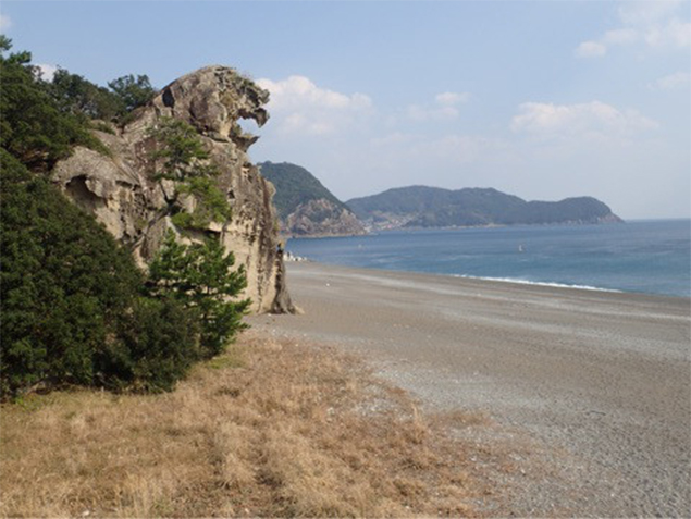
Shishiiwa
We returned to the beach again from the town of Kinomoto, and went on a tour of Shishiiwa, one of the places of scenic beauty.
Shishiiwa is a rock shaped like a lion barking toward the sea.
Cool!
I heard that a fireworks display is held here in summer.
Walking on Shichiri-mihama Beach from Shishiiwa, we finally came to Hana no Iwaya.
- 11:15
-
Hana-no-Iwaya
This is a place of great excitement for someone like me who is interested in ancient mythology.
It’s one of the places that I looked forward to before I started to walk along the Ise-ji Route.
This place is said to have been the burial place of Izanamino Mikoto who is the deity of kuniumi (literally “birth or formation of the country”).
The object of worship in Hana-no-Iwaya Shrine is a large rock approximately 45m high. It certainly feels like an iwakura (a rock in which deities dwell) in the ancient belief.
Hana-no-iwaya Shrine has no worship hall, and the large hole in the lower part of the large rock is said to have been the burial place of Izanami.
After visiting Hana-no-iwaya Shrine, Mr. Yamakawa bought dumplings made from ancient rice for me at a nearby roadside station “Kumano Hana-no-Iwaya.”
Thank you for the dumplings.
This is the end of my walk along the Kumano Kodo route today. I parted with Mr. Yamakawa as well.

- 11:50
-
Sagiri no Sato, Tori-toge Pass, and Maruyama Senmaida Rice Terraces
From Hana-no-Iwaya Shrine, the route diverged into Hama-dori street, which leads to Kumano Hayatama Taisha (Shingu) when one walks along the beach, and Hongu Road, which leads to Kumano Hongu Taisha when one goes down the road in a mountainous area. The main course of the current Ise-ji Route is Hama-dori street.
Since I wanted to see the Hongu Road route as well, I asked this day's support staff to drive me to the tourist attractions along Hongu Road.
It was about the time to have lunch, so I ate Iwashimizu Pork for lunch at Sagirichaya.
The Oroshi district in Mihama Town, where Sagirichaya is located, is famous for its Fuden Oroshi, a meteorological phenomenon of the morning mist crossing over the mountain and descending onto the village at the foot of the mountain due to a difference between cold and hot atmospheric temperatures.
This phenomenon seems to have occurred several days before. I will try to wake up early tomorrow!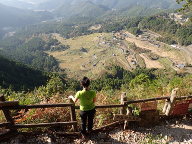
I decided to walk through Tori-toge Pass along Hongu Road, and to look down on Maruyama Senmaida Rice Terraces from an observatory located on top of a mountain.
Tori-toge Pass is 2.1km long. After going up a mossy stone-paved road for about 20minutes, and further up to the observatory from the pass for another 20minutes, I arrived at the observatory that commands the view of Maruyama Senmaida Rice Terraces below.
The scenery seen from here was certainly superb. As described by the name of "Senmaida (literally, thousand paddy fields)," I had heard that Maruyama Senmaida Rice Terraces have as many as some1,340 paddy fields.
The terraces seem to have already existed in the Sengoku Period (Period of Warring States), when the terraces were twice the size those in these days.
I was amazed by the effort of people who created so many paddy fields.
- 15:10
-
Yunokuchi Hot Springs
Driving down National Route 311 further to the west, I arrived at Seiryusou.
Heading for Yunokuchi Hot Springs by trolley from the accommodation, I stayed at a bungalow, which had been renovated and opened.
Yunokuchi Hot Springs use free-flowing spring water, and were great with a spacious open-air bath.
The standing bath there was very rare for me.
To be continued on the Day 11.
Day 11Hana no Iwaya - Atawa – Ida Distance of
8.5km
- Walking distance:
- Approximately 26.0km
- Activity time:
- Approximately 6.5hours
- ※The walking distance is based on the GPS log. The distance includes the total distance of my side trips in this section, and is different from the actual distance between the starting point and the destination.
- ※The activity time includes not only the walking time but also lunch time, rest time, and hours of stopping over.
- 7:30
-
Former site of Akagi Castle
Unfortunately, I was not able to see Fuden Oroshi, but since I got up early and had some time, I was able to drive to see the former site of Akagi Castle, which is located in Kiwa Town in Kumano City.
Akagi Castle was built by Todo Takatora, who was a retainer of Toyotomi Hideyoshi, in order to quell the uprising of Ikko sect followers, which had occurred frequently.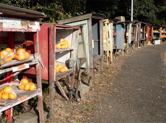
On my way back to the Hama Kaido Route of the Ise-ji Route, I found an interesting thing along National Route 311.
I saw so many mandarin oranges sold at unmanned shops all standing in a row.
Peeping into these shops, mandarin oranges were sold at 100 yen per ten-orange bag. Cheap!
- 10:40
-
Hama-kaido Route
Afterwards, I went back to Hana-no-Iwaya, and resumed walking along the Ise-ji Route again.
Walking along an old road, I saw a standing stone road sign.
I heard that with the indication of “Right way to Hongu, left way to the Pilgrimage road,” people heading directly for Hongu and people visiting Nachi parted here.
I went down the road on the left and came to a coastal area again.
From here on, I walked in a fashion of strolling in a windbreak. When I lost interest in walking in a forest, I went to the breakwater, and got a wide view of the sea.
After seeing the historic site of Ichigi no Ichirizuka, I got back into the windbreak again. Going along the beach, I saw the Mihama Mandarin Orange Festival held at the Roadside Station Park Shichiri Mihama. I will stop by the mandarin orange festival!
Wow, Mihama Town is a “town where mandarin oranges can be harvested throughout the year!”
Walking along National Road 42 for a while, I entered Kiho Town.
It was just the time to have lunch, so I decided to have a lunch buffet at a restaurant in the roadside station.
In this restaurant, visitors can enjoy various types of dishes such as Japanese style and Western-style ones. Can't decide what to eat!
On the second floor of the roadside station, replicas of citrus fruits were displayed.
There were so many varieties of citrus fruits there which included unfamiliar varieties of mandarin oranges, such as Seminole and Orange Hyuga.
In this roadside station, visitors can see an artwork of juice flowing from the ceiling, and can even go on a tour of a juice factory where they can observe the production process through glass.
I wanted to drink it, and found that it was sold at the sales corner on the first floor.
While walking along the old road from the Roadside Station Park Shichiri Mihama, I saw various types of unmanned selling places along this road—fruits, vegetables, and newspapers, as well as compost and rice bran...
It's good to enjoy such a peaceful atmosphere.
After that, walking along National Route 42 for a while, I entered Kiho Town.
Next roadside station was Kiho Town Seaturtle Park.
Seeing a sign that reads that there are sea turtles, I wondered if those were stuffed sea turtles or something.
I saw real sea turtles!
It is surprising that there are sea turtles in a roadside station.And it seems that visitors can feed them.
In addition to sea turtles, there were other sea creatures, such as puffers and moray eels in this roadside station.
At the sales corner, visitors can enjoy freshly-squeezed juice, and can purchase a local specialty called “Mehari-zushi (rice ball wrapped with mustard leaf).”
- 15:10
-
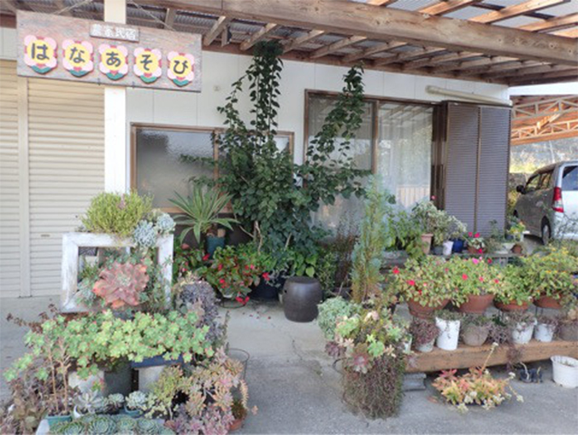
Farmhouse inn HANAASOBI
When I finished walking down the road to Ueno Intersection in Ida, it was the end of my walking along the Ise-ji Route this day.
I arrived at Farmhouse inn HANAASOBI which is located in the Kounouchi District about 2km away from Ueno Intersection.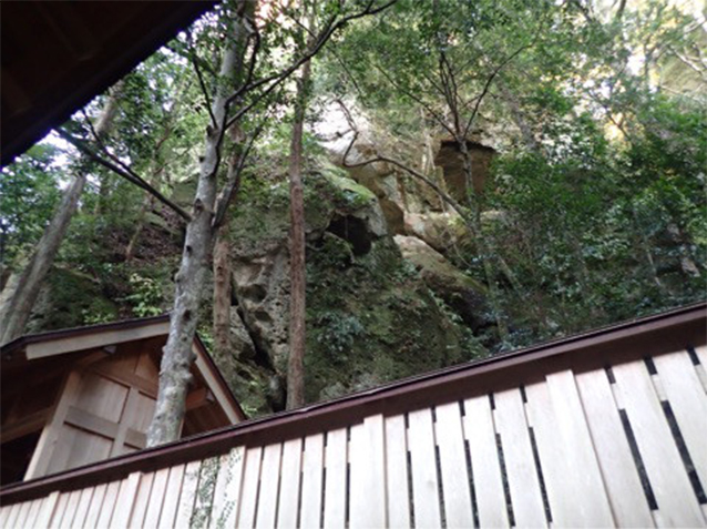
In HANAASOBI, visitors can have various types of experiences.
As one of these experiences, I asked Landlady Naoko to take me to Kounouchi Shrine.
When standing at the entrance of this shrine, I had an intuition that this has long been a place of religious faith (probably from ancient times).
Located along the approach of this shrine was a cave with the inscription of Chinese characters meaning “Shrine of Emperor Jinmu.” So mysterious!
After going up steep stairways, and walking through the gate with the indication of Chinese characters meaning “Koyasu no Miya,” I saw a huge rock, which is the object of worship, rising at the back of tamagaki fences. With no shrine building, I was able to see traces of ancient belief in which people directly prayed to the huge rock, the object of worship.
Next, I also asked her to take me to a place called “Koshinden” which is said to be the former site of a holy shrine from primitive times located approximately 400m before Kounouchi Shrine. This seems to have been a place where ancient religious services for divine spirits were held and where a shrine maiden called “Negihime” pronounced the words of deities. This is certainly an iwakura (rock in which deities dwell).
After the tour around the Kounouchi District, I returned to HANAASOBI.
Since I had some time before dinner, I had one more activity to experience, which was making a moss ball.
I created my moss ball by making soil into a ball shape, planting saxifrage, ferns, and honeworts, and wrapping it with moss.
My work turned out really well.
I was entertained as if I were family with dinner in a living room.
All dishes were prepared by Narako.
In addition to the sashimi (sliced raw fish), the boiled rice grown by Naoko and her father was really good.
According to them, people in Kounouchi cook gomoku gohan (Japanese mixed rice) with peanuts in it during a festival.
This was also so delicious that I asked them to prepare it for my lunch after leaving the accommodation.
I was sent off by Naoko and the landlord of HANAASOBI, and departed from the accommodation for my final day of my journey along the Ise-ji Route!
To be continued...
Day 12Ida - Kumano Hayatama Taisha (Shingu) Distance of approximately
2.0km
- Walking distance:
- Approximately 6.2km
- Activity time:
- Approximately 8hours 35minutes
- ※The walking distance is based on the GPS log. The distance includes the total distance of my side trips in this section, and is different from the actual distance between the starting point and the destination.
- ※The activity time includes not only the walking time but also lunch time, rest time, and hours of stopping over.
- 9:00
-
Left HANAASOBI
My journey along the Ise-ji Route has finally come to its final day.
Sent off by the landlord and landlady of HANAASOBI, I started to take steps toward the final route.
I aimed for Kumano Hayatama Taisha (Shingu).
I only have 2km left till the goal of my journey along the Ise-ji Route.
- 11:00
-
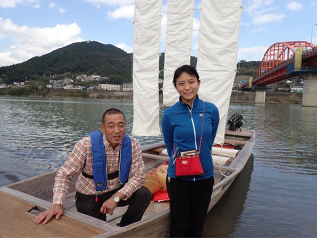
Enjoyed Kumano River Santanho pleasure cruise
I came to the bank of the Kumano River, which was the opposite side of Kumano Hayatama Taisha (Shingu).
The Kumano River, which connects Kumano Sanzan (three Grand Shrines of Kumano), was registered on the World Heritage List as "a river pilgrimage route."
The river is the only World Heritage River in the world.
That's why I rode on a Santanho pleasure ship as an event to adorn the finale of my journey along the Ise-ji Route.
Santanho is a sailing ship that features a long slender sail. I accessed the website of Kumano Gawa Taikan Juku that plans experience tours at.
I rode on a Santanho pleasure ship wearing a bamboo hat, because the sunshine is strong on the river surface. The captain of the ship was Mr. Shoji.
Sailing up the river a little, he took me to a point from which we were able to view a magnificent columnar joint.
We slowly sailed down the river appreciating the scenery around us.
The National Route and the bridge of the Kisei Main Line also came in sight.
At a point we passed under the bridge of the Kisei Main Line, the captain put up all sails. It feels graceful with the sails swelling in the wind.
Then I arrived at the entrance area of Kumano Hayatama Taisha on the opposite side of the Kumano River.
Mr. Shoji, thank you for taking me to the Kumano Hayatama Taisha area.
- 13:00
-
Kumano Hayatama Taisha (Shingu)
Kumano Hayatama Taisha is located in a place close to the bank of the Kumano River.
On the Day12 from the departure from Ise, I finally arrived at my goal, Kumano Hayatama Taisha!
Going through the precincts, I visited the hall of worship.
I made a formal sampai (visit and worship), and asked a priest to recite a Shinto prayer for me.
During the recitation, I looked back on the various events in my journey along the Ise-ji Route, and was deeply thankful for my safe walking and fulfilling journey.
However, I began to feel a sense of emptiness from the thought that my fun journey will end today.
In that mood, a priest's words delivered at the end of my visit to this shrine, “Based on the experiences you gained from walking along the Ise-ji Route, please take new and powerful steps from tomorrow,” resonated warmly in my heart.
- 14:00
-
Kamikura Shrine
I reached the goal of my journey along the Ise-ji Route by arriving at Kumano Hayatama Taisha, but...
What are these stairs for?!
Kumano Hayatama Taisha has its auxiliary shrine of Kamikura Shrine that is a sacred ground, the first place where four Kumano Okami, the four enshrined deities of Kumano, are said to have landed. The shrine is located in Mt. Kannokura, and visitors have to go up steep stairs of more than 500 flights to get to the shrine. This must be the final ordeal...
Kamikura Shrine was enshrined beneath a huge rock called “Gotobiki Rock.” This place commands a panoramic view of the town of Shingu.
At my feet was a colony of G. sikokiana Maxim, which I also saw at Magose-toge Pass.
-
Kumano Nachi Taisha (Nachikatsuura)
Since I had a little more time on this day, I was given a lift in the car for the 20km-ride, and visited Kumano Nachi Taisha as well.
Because, despite my reaching the goal of my journey along the Ise-ji Route, I can't be convinced to finish it until I pay visits to the three grand shrines of Kumano, Kumano Hongu Taisha, Kumano Hayatama Taisha (Shingu) and Kumano Nachi Taisha (Nachikatsuura).
Climbing up a mountain again, I came to Kumano Nachi Taisha.
Nachi Falls were extremely powerful.
Since this was a place of Shugendo practice, which was based on the syncretization of Shinto with Buddhism, from Seiganto-ji Temple located next to Kumano Nachi Taisha, I was able to enjoy scenery unique to Japan, such as a three-story pagoda, and large waterfalls.
Returning home dayKumano Hongu Taisya and Kii Main Line trip
-
Kumano Hongu Taisha
On the following day, I rode on a bus departing from Shingu Station to visit the remaining part of Kumano Hongu Taisha.
After leaving Kumano Hongu Taisha, I got on a bus again back to Shingu Station, and headed for Nagoya on a limited express train of the Kisei Main Line.
Since the Kisei Main Line was constructed so that it runs along the Ise-ji Route, I crossed the main line many times while I was walking along the course.
So, every view from the train looked very familiar, and it was like tracing back my journey along the Ise-ji Route.
Seeing various places, and learning about various things, I took to Mie very much.
I wish to walk along the Ise-ji Route again.
Lastly...
“Kumano e mairu ni wa (To visit Kumano,)
kiji to iseji to dore chikashi dore tooshi (Which is farther, and which is closer, going along Ki-ji route or Ise-ji route?)
koudai jihi no michi nareba (If it is the route of great mercy,)
kiji mo iseji mo tookarazu (Both of the routes feel close,)” quoted from "Ryojin Hisho" (Songs to make the Dust Dance)
Thank you very much.